SQUALLS EXPECTED IN SNOW BELT
Rounds Of Light Snow
Continue In Mid-Week
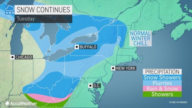
If Otsego County winter lovers have been disappointed by a generally mild January thus far, a return to wintry conditions has commenced and will continue into midweek.
Areas of snow and flurries that persisted from Sunday night to Monday morning were part of the old storm that affected the region over the weekend.
At the start of this past weekend, a large storm system pushed across the Great Lakes and into the Northeast and spread an expansive swath of snow. Accumulating snow from this storm also blanketed portions of the Ohio and Tennessee valleys. About 1-2 feet of snow piled up over the Adirondack, Green and White mountains of the interior Northeast.
The effects of this old storm will be replaced with a common January pattern of weak storms that travel from the northern tier of the Midwest to northern New England through the end of this week. The pattern will produce rounds of lake-effect snow, as well as patches of general snowfall. The pattern will also allow waves of cold air to move southward from Canada, now that Arctic air has moved into Canada.
“The atmospheric pattern is setting up in a manner that will deliver multiple rounds of relatively weak storm systems diving southward from central Canada over the next week or so,” AccuWeather Meteorologist Brandon Buckingham said. “These storm systems will not feature ample amounts of moisture within them, so overall snowfall accumulations within each passing disturbance should remain relatively light.”
“Although major snowfall accumulations are not expected across a majority of the Midwest and Northeast this week, the rounds of light snowfall will likely cause travel issues for some,” Buckingham explained. “Sometimes, a light snowfall event can give drivers a false sense of security in thinking that road conditions may not be so bad, but at times, these ‘minor’ snowfall events can actually lead to more traffic accidents than major snowstorms.”


